A thousand dollars used to buy you a single feature done well. Now it buys you everything: MEGA Imaging, preloaded professional-grade charts, full networking, 9-inch screens with side scan sonar that would have been pro tournament gear four years ago.
The ceiling in this bracket has moved so far up that the harder question isn’t “what can I get?” — it’s “which combination actually matches the way I fish?”
Seven units. Six weeks. Four different water types. Here’s what we found.
Top Picks
BEST OVERALL: Garmin Striker Vivid 7sv
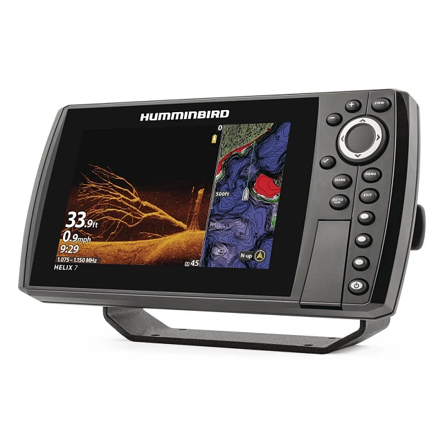
BEST MEGA IMAGING: Humminbird Helix 7 CHIRP MEGA DI GPS G4
BEST 9-INCH DISPLAY: Garmin Striker Vivid 9sv
BEST CHARTPLOTTER: Garmin ECHOMAP UHD2 74cv
BEST ALL-IN-ONE SYSTEM: Lowrance Elite FS 7
BEST NETWORKED BUILD: Humminbird Helix 7 CHIRP MEGA DI GPS G4N
BEST SIDE IMAGING: Humminbird Helix 7 CHIRP MEGA SI GPS G4N
How We Tested
Fish finders at this level all look impressive in demos. The gap shows up when the bottom drops fast, the sun hits the screen wrong, and you have maybe three seconds to read what’s there before the boat moves past it.
We spent six weeks engineering those three seconds — same passes, all seven units running simultaneously, four different water types — until the differences stopped being debatable.
Detailed Reviews
1. Garmin Striker Vivid 7sv
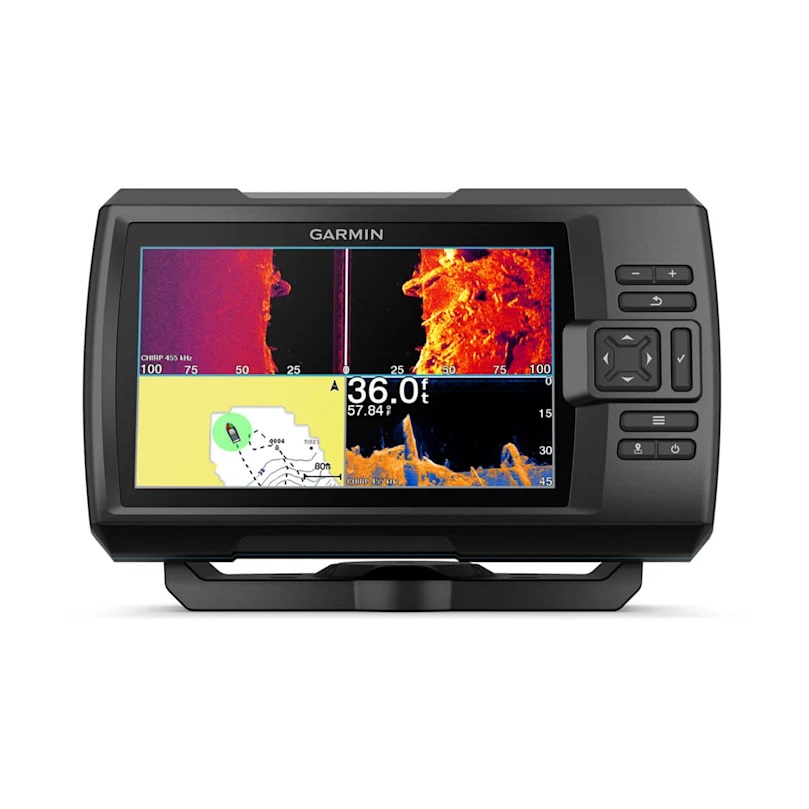
The Striker Vivid 7sv opens up side imaging without the complexity of a networked system — and SideVü at 250 feet per side changes how fast you cover water.
On our flooded timber reservoir, two passes gave us four distinct holding areas marked before the first cast. That’s what side scan does when the transducer and display are tuned correctly.
The Vivid display held up at 11 AM full sun without a palette adjustment. Seven color options aren’t decorative — “Blue Water” on clear water, “High Contrast” on stained, both noticeably cleaner than competing units running auto mode.
Wi-Fi via ActiveCaptain and Quickdraw Community access makes the no-preloaded-maps limitation easier to live with than it sounds.
Key Specifications |
|
|---|---|
| Display | 7″ color LCD, 800×480, 7 Vivid palettes |
| Sonar | CHIRP Traditional + ClearVü + SideVü |
| GPS / Mapping | GPS + Quickdraw Contours |
| Transducer | GT52HW-TM (included) |
| Max Depth | 800 ft (Traditional) / 500 ft (ClearVü/SideVü) |
| Wi-Fi | Yes — ActiveCaptain |
2. Humminbird Helix 7 CHIRP MEGA DI GPS G4
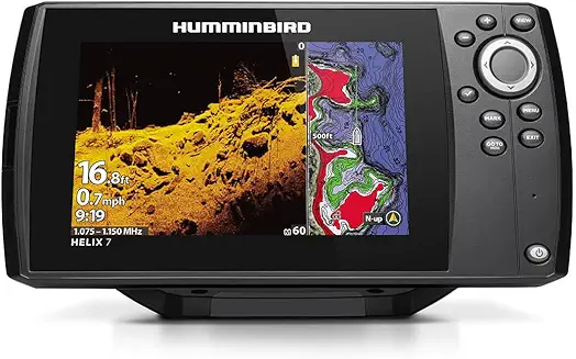
MEGA DI at 1.2 MHz doesn’t just show you more — it shows you differently. Standard DI renders a brush pile as a mass of targets.
MEGA DI separates individual fish within that pile, shows you exactly where they’re sitting relative to cover, and gives you somewhere specific to drop a bait.
Over a 24-foot brush pile in testing, we placed a jig between two distinct marks and got bit before it reached the bottom. The unit running standard DI in parallel showed the same area as noise.
AutoChart Live records depth, bottom hardness, and vegetation simultaneously as you drive — three data layers building every session. Combined with 10,000+ lakes already in the Basemap on day one, this is the unit for anyone who fishes structure seriously.
Key Specifications |
|
|---|---|
| Display | 7″ color LCD, high-definition |
| Sonar | Dual Spectrum CHIRP + MEGA Down Imaging (1.2 MHz) |
| GPS / Mapping | Humminbird Basemap + AutoChart Live |
| Transducer | XM 9 MDI T (included) |
| Max Depth | 1,200 ft (CHIRP) / 125 ft MEGA range |
3. Garmin Striker Vivid 9sv
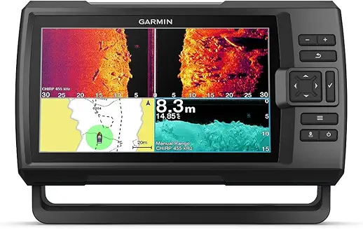
Same GT52HW-TM transducer, same sonar capability, same Wi-Fi as the 7sv — the 9sv’s entire argument is the screen. Two inches sounds minor until you’re running at 12 mph reading SideVü returns.
We put both units side by side on the same passes: the 9sv image was clearly readable at speed, the 7sv required slowing down to interpret the same data comfortably. For anyone covering a lot of unfamiliar water in a session, that difference compounds across a full day.
The 7 Vivid palettes perform identically on the larger canvas — if anything, the extra real estate makes switching between “Blue Water” and “High Contrast” modes feel more deliberate, because you’re actually reading more of the image at once.
Quickdraw Contours, ActiveCaptain, IPX7 waterproofing — all the same. The trade-off is purely physical: the 9sv needs more console space, and it’s not a kayak unit.
Key Specifications |
|
|---|---|
| Display | 9″ color LCD, 800×480, 7 Vivid palettes |
| Sonar | CHIRP Traditional + ClearVü + SideVü |
| GPS / Mapping | GPS + Quickdraw Contours |
| Transducer | GT52HW-TM (included) |
| Max Depth | 800 ft (Traditional) / 500 ft (ClearVü/SideVü) |
| Wi-Fi | Yes — ActiveCaptain |
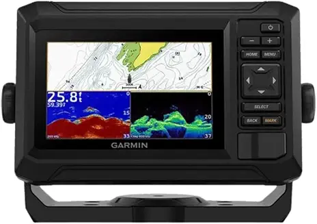
The ECHOMAP UHD2 74cv is built for anglers who fish new water constantly and want a real chart on arrival — not something to build first. LakeVü g3 inland maps and BlueChart g3 coastal charts with Navionics data are preloaded from day one.
We launched on a lake we’d never fished and had 1-foot contour data on screen within 30 seconds of powering on. No setup, no downloading, no guessing.
The GT20-TM transducer adds clean CHIRP and ClearVü sonar on top of that mapping foundation, and Quickdraw Contours fills in anything the preloaded chart misses.
Wi-Fi sharing between compatible ECHOMAP UHD2 units passes sonar, waypoints, and routes wirelessly — a dual-display setup without networking complexity.
Key Specifications |
|
|---|---|
| Display | 7″ color LCD, sunlight-readable |
| Sonar | CHIRP Traditional + ClearVü |
| GPS / Mapping | LakeVü g3 + BlueChart g3 + Navionics+ support |
| Transducer | GT20-TM (included) |
| Max Depth | 1,900 ft (Traditional) / 750 ft (ClearVü) |
| Wi-Fi | Yes — unit-to-unit sharing + ActiveCaptain |
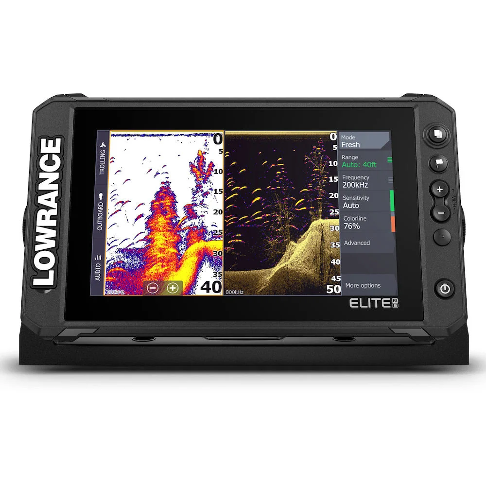
FishReveal is what separates the Elite FS 7 from everything else at this level: CHIRP fish arches overlaid directly on the DownScan image in real time, both views simultaneously on one screen.
On our brush pile testing, the DownScan showed the structure; the CHIRP arches showed exactly where fish were sitting within it. We cast to specific positions based on that combined image and caught fish on water we’d struggled to read before.
The Active Imaging 3-in-1 transducer delivers CHIRP, SideScan, and DownScan from a single unit. C-MAP Discover OnBoard covers 15,000+ U.S. lakes with 1-foot contours preloaded, Genesis Live builds ½-foot custom maps in real time, and the full NMEA 2000/Ethernet suite supports Power-Pole, trolling motors, and radar.
When you’re ready, adding ActiveTarget 2 Live Sonar upgrades the entire system without replacing the display.
Key Specifications |
|
|---|---|
| Display | 7″ multi-touch, flat glass, anti-reflective coating |
| Sonar | CHIRP + Active Imaging SideScan + DownScan + FishReveal |
| GPS / Mapping | C-MAP Discover OnBoard + Genesis Live (½-ft contours) |
| Transducer | Active Imaging 3-in-1 (included) |
| Networking | NMEA 2000, Ethernet, Wi-Fi |
Same MEGA Down Imaging and Dual Spectrum CHIRP as the G4 — the G4N adds full Ethernet networking.
On a boat running a Minn Kota trolling motor with Universal Sonar 2, that means sonar data from the trolling motor transducer displays directly on the Helix 7 screen, eliminating the need for a second bow transducer entirely.
We tested this pairing via One-Boat Network: MEGA DI image quality was identical to a directly wired setup, no signal degradation.
Bluetooth connects Talon and Raptor shallow water anchors for screen control. Wi-Fi handles software updates and smartphone notifications via FishSmart.
NMEA 2000 brings in engine, tank, and weather data. The G4N is a hub — if you’re building a system rather than running a single unit, this is the platform.
Key Specifications |
|
|---|---|
| Display | 7″ color LCD, high-definition |
| Sonar | Dual Spectrum CHIRP + MEGA Down Imaging (1.2 MHz) |
| GPS / Mapping | Humminbird Basemap + AutoChart Live |
| Transducer | XM 9 MDI T (included) |
| Networking | Ethernet, Bluetooth, NMEA 2000, Wi-Fi |
| Max Depth | 1,200 ft (CHIRP) |
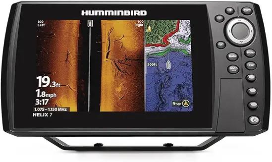
MEGA SI at 1.2 MHz covers 125 feet per side — 250 feet total per pass — with resolution that shows individual boulders, isolated timber, and bottom composition changes that standard 455 kHz SI renders as texture.
On our main-lake ledge testing, we identified a laydown tree 90 feet to port in enough detail to distinguish individual branches.
In one 600-foot bank pass, seven structural targets marked; four produced fish. A down-imaging unit would have needed seven separate targeted passes to find the same information.
MEGA Down Imaging is also included, and the full G4N networking suite runs underneath both: One-Boat Network, Minn Kota integration, Bluetooth anchor control, wireless updates.
AutoChart Live builds three-layer maps on every session. This is the unit that changes how fast you learn unfamiliar water.
Key Specifications |
|
|---|---|
| Display | 7″ color LCD, high-definition |
| Sonar | Dual Spectrum CHIRP + MEGA Side Imaging + MEGA Down Imaging |
| GPS / Mapping | Humminbird Basemap + AutoChart Live |
| Transducer | XHS 9 HDSI 180 T (included) |
| Networking | Ethernet, Bluetooth, NMEA 2000, Wi-Fi |
| Max Depth | 1,500 ft (CHIRP) / 125 ft per side (MEGA SI) |
Fish Finder Buying Guide
The Sonar Hierarchy at This Level
At this price point, CHIRP is baseline. The real decisions are what’s stacked on top.
Down Imaging (ClearVü / DownScan / DI) shows structure and fish directly beneath the boat in near-photographic detail. MEGA Down Imaging (Humminbird, 1.2 MHz) goes further — 3× the resolution of standard DI, showing individual fish within structure rather than a general cluster of marks. The difference is meaningful specifically when you need to place a bait in a precise location.
Side Imaging changes how fast you find structure. Instead of passing directly over every feature, you scan wide corridors and mark what appears on either side. A unit with SI covers the same water in a fraction of the passes. MEGA Side Imaging does the same thing at 125 feet per side with resolution sharp enough to distinguish individual pieces of cover.
FishReveal (Lowrance) overlays CHIRP fish arches on the DownScan image simultaneously — no page switching, no split-screen guessing. When it works well, it’s the clearest single-screen sonar view available at this price point.
Preloaded Maps vs. User-Built Maps
This is the most meaningful decision in the bracket. The ECHOMAP UHD2 and Elite FS 7 arrive with professional-grade preloaded charts — you fish new water immediately, with 1-foot contour detail, on the first cast. The Humminbird units give you AutoChart Live: every session builds a more accurate, more detailed map of your home water that grows with each trip. The Garmin Striker units give you Quickdraw Contours, which builds clean user maps but requires you to drive the water first.
None of these approaches is wrong. But if you fish varied water and rarely return to the same lake, preloaded coverage wins. If you fish the same two or three bodies of water deeply, AutoChart Live eventually outperforms any preloaded chart.
Networking: When It Matters
The G4N models and the Elite FS 7 support Ethernet, NMEA 2000, and wireless connectivity. This matters if you’re running a trolling motor with built-in sonar (shared display without a second transducer), building a dual-display console, or integrating shallow water anchors and radar. For a single-display setup on a small to mid-sized boat, the networking capability costs money without delivering a meaningful return.
Screen Size
Seven inches is the functional baseline for a full day of reading sonar. Nine inches — the Striker Vivid 9sv — adds meaningful legibility at speed and reduces the interpretive effort on complex imaging views. For console-mounted primary units, 9 inches earns its footprint. For kayak, tiller, or bow-mounted secondary units, 7 inches is the practical call.
Final Verdict
For most anglers in this bracket, the Garmin Striker Vivid 7sv provides the best balance of capability, simplicity, and value: three sonar types, a Vivid display, Wi-Fi, and side scan capability without the setup overhead of a networked system.
If imaging quality is the primary driver and you fish structure hard — timber, ledges, rock transitions — the Humminbird Helix 7 CHIRP MEGA DI GPS G4 delivers MEGA Down Imaging precision that changes what you see at depth. The structural detail it produces changes the decisions you make before you cast.
For the angler who fishes new water constantly and wants a real chart on arrival without building it first, the Garmin ECHOMAP UHD2 74cv is the preloaded mapping answer: LakeVü g3 and BlueChart g3 with Navionics data, on a clean 7-inch display, from the first minute on the water.
The Lowrance Elite FS 7 is the most forward-compatible unit in the guide — FishReveal, SideScan, DownScan, preloaded maps, and ActiveTarget 2 Live Sonar-ready. If you expect to grow your setup over the next few seasons, this is the platform that scales with you without replacing the display.
And if side imaging is the capability you’ve been waiting to add, the Humminbird Helix 7 MEGA SI G4N sets the standard. Nothing in this guide covers unfamiliar water faster or with more detail per pass.
The fish aren’t hiding. At this level, neither are they.